Zoning Intelligence Platform
A property intelligence platform that turns complex municipal zoning data into instant, structured answers for real estate consultants, developers, and planners in Oregon.
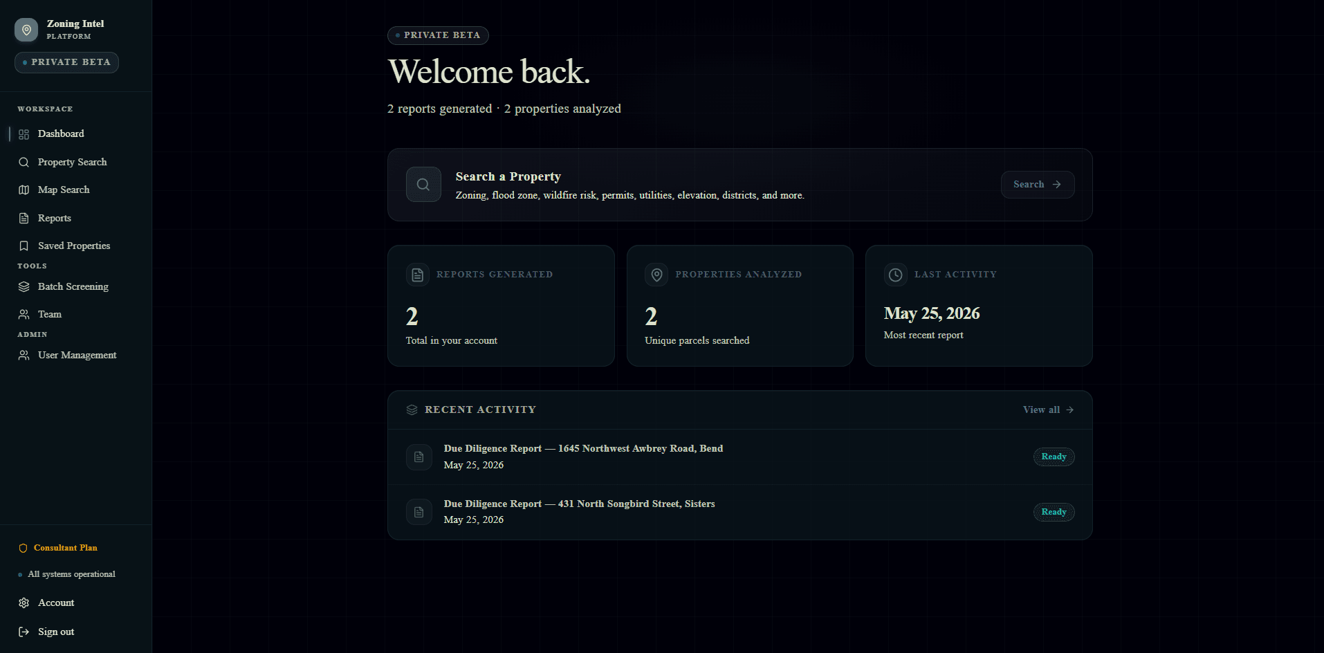
Activity overview: reports generated, properties analyzed, and recent due diligence jobs at a glance.
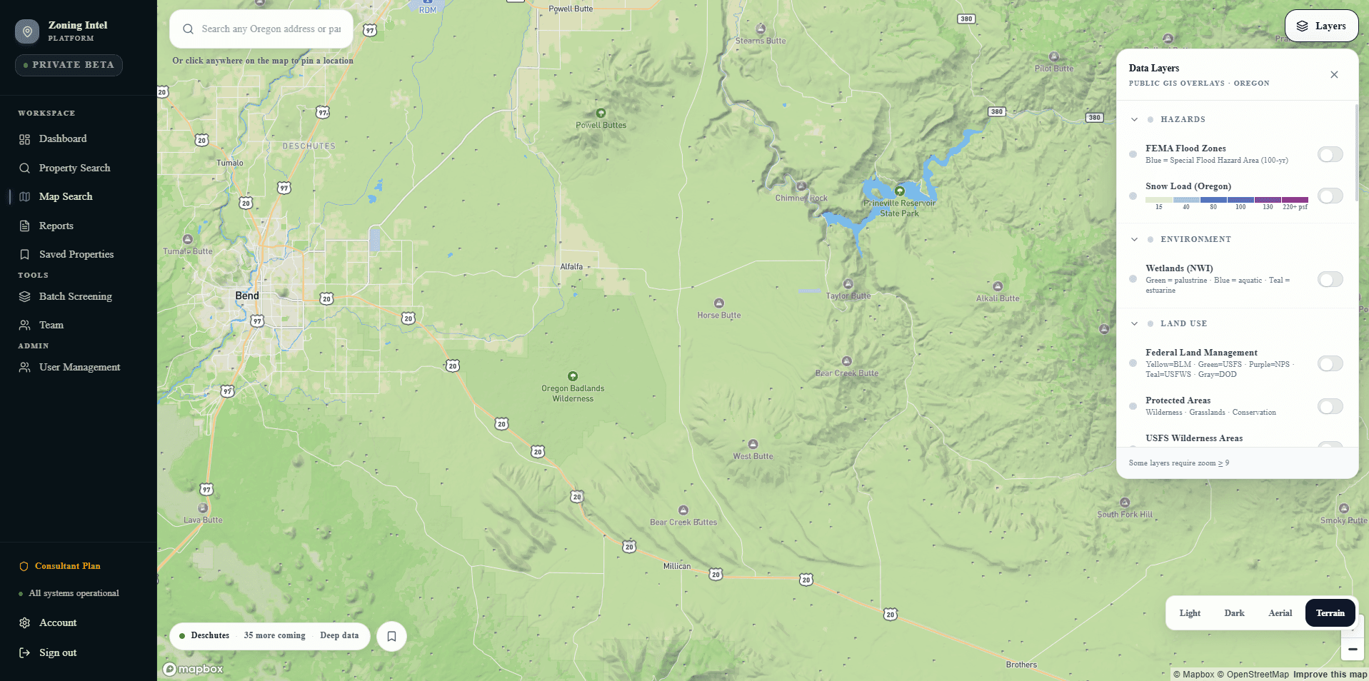
Mapbox terrain view with toggleable GIS overlays including FEMA flood zones, wetlands, and land management boundaries.
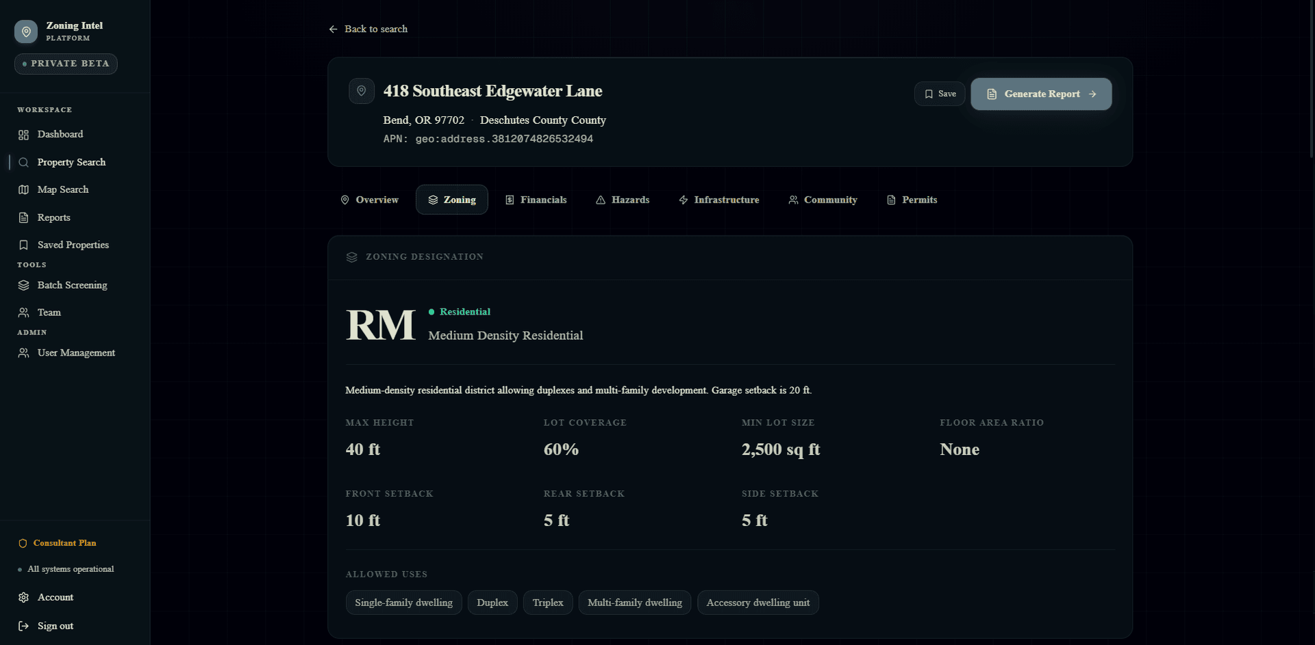
Full zoning breakdown for any parcel: designation, max height, setbacks, lot coverage, floor area ratio, and allowed uses.
What it does
Property Search
Search any Oregon address and get instant zoning designation, setbacks, allowed uses, lot coverage limits, and more in one clean view.
Interactive Map
A Mapbox-powered map with toggleable GIS data layers: FEMA flood zones, snow load, wetlands, federal land management, protected areas, and wilderness.
Due Diligence Reports
Generate a structured property report covering zoning, financials, hazards, infrastructure, community data, and permits with one click.
Batch Screening
Screen multiple parcels at once against zoning and hazard criteria, saving hours of manual lookup for consultants working large pipelines.
Team Access
Multi-user workspace with role-based access and a shared activity feed, so everyone on a project team works from the same data.
Subscription Tiers
Consultant Plan and higher tiers give clients scoped access to the platform on a monthly subscription with no per-report fees.
Want a platform built for your business?
We scope, build, and operate it for you on a subscription. Book a call and tell us what you need.